The river Noyyal emerges in the Velliangiri Hills which is at a height of 1778m from the sea level in the Western Ghats. This river is the tributary of the river Kaveri.
Why name Noyyal?
In Tamil history, the Noyyal is a sacred river in the Tamil History. Initially this river was known as Kanchi Nadi, but later this was known as Noyyal. In Tamil language, Noyyal means one who relieved from the disease.
Flowing area
In Tamil Nadu, the river Noyyal, flows through the Tiruppur and Coimbatore. This river land in the Valley, then continues to the east flowing through the Perur, Irukoor, Mangalam, Kuniyamuthoor, Vellaloor, Orathupalayam and Tiruppur. After this river travels for 180Km, it mixes with the Cauveri river at the Noyyal village. This Noyyal Village is situated on the banks of the Noyyal river.
The total area covered by this river basin is 3500Km2, with a width of 25Km and length of 180Km.
Geography of river in Olden days
During the period of Chalukya Cholas King, the storage tank and the channel was built. This tank along with the channel system of this Noyyal river, gave the benefits such as the storage, transport and control of the groundwater level. Then the extra water from the river was diverted into the channels avoiding the floods.
Decrease in river size
In the olden days, the Noyyal river covered the Coimbatore city. But later, this system failed and now only 11 tanks were left. Due to the water scarcity, this system does not work, resulting in the reduction of the agriculture. Then the coconut plantations have seen a huge reduction due to the dry up of this river. Earlier, nearly 350000 hectares of coconut trees were irrigated by this river, but now this has been reduced. The replenishment of this river, will increase the irrigation activity in the agricultural lands.
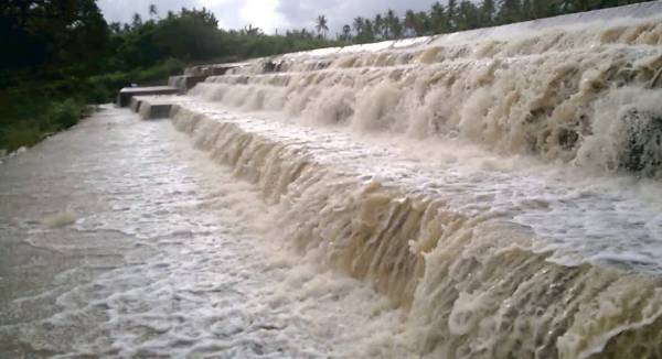
Dams and uses of the river
There are two Dams across this river namely Aathupalayam Dam at the Vellakoil and the Oruthuppalayam Dam at the Chennimalai. These two Dams irrigate nearly more than 20000 acres of land in the Karur and the Tirupur Districts.
- This river irrigates a large number of coconut trees.
- The water of this river is used by the Coimbatore City for drinking water source.
- This river provides the water for 9 to 10 months.
- This water travels through all the nearby places and so the groundwater is available within the 40-50 feet from the ground level.
Temple and Valley
At the place where the Noyyal and Kaveri rivers meet, there is an ancient temple of the Goddess Sellandiyamman in Sangaman. The Valley on the bank of this river is filled with the alluvial soil to a depth of about 60m.This alluvial soil extracts the water content, thus protects the City from the floods. This soil has the extension till Ukkadam Tank from its origin place Kooduthurai.
Condition of river
This river Noyyal is filled with a lot of encroachments and Pollutants these days. Then the textile industries have left a huge impact on the river by polluting with the chemicals and the effluents. Additionally, Oruthuppalayam Dam is acting as the effluent tank for the textile industries of Tirupur. To Know more other famous river thenpennai .
Things to follow to save this river water
- The responsible people can grow more trees to avoid the sand corrosion.
- Then the proper sewage treatment must be made.
- Next use only the minimal amount of the water to save the underground water.
- The self hygiene and the public awareness can also save the water.
Things not to be done to save the river
- The residents and other visitors must not allow themselves or others to put the insecticides and the plastics in the river.
- Then the officials must not allow to function any hazardous industries near the river.
No one must steal the sand from the river area as that may reduce the life of the river.
Flowing State: Tamil Nadu
Flow area: 3500Km2.
Origin Place: Velliangiri Hills, Western Ghats, Tamil Nadu.