The river Vaigai emerges in the Periyar Plateau in the Varusanadu Hills. This Varusanadu Hills is with the height of 1650 metres above the sea level in the Western Ghats.

Flowing area
Vaigai river flows through the Kambam Valley in the northeast direction. This Kambam Valley is situated between the Varusanadu Hills and the Palani Hills. In Madurai, this river flows at a distance of 240Km from West to East direction. The Madurai city is situated on the banks of this river. This river flows at a distance of 258 Km starting from its origin.
Tributaries
The Varaganadi river, Mullaiyaaru river, Manjalaru river, Alagar river, Kottagudi river, Kridhumaal river and Suruliyaaru are the important tributaries of the Vaigai river.
Then this river covers nearly 20 taluks and the urban areas like the Cumbum, Madurai, Uthamapalyam, Theni, Nilakottai, Manamadurai, Melur, Periyakulam, Bodinayakkanur, Manamadurai, Ramanathapuram and Paramakudi.
Vaigai river basin
The Western Ghats surround the Vaigai river basin on the south side and the west side. Then the southern slopes of the Sirumalai hills, Palani hills (Kodaimalai hills) and Alagar hills are the other hills that cover this river basin. This river is also surrounded by the Pambar Kottakaraiyar and the Cauvery basins on the north. In the west the Periyar basin covers this basin and the Gundar basin on the south sides.
History
During the King Pandyas period in 300 B.C, the Princess Meenakshi who was the incarnation of the Goddess Parvati wished to marry God Siva. Even though the King initially refused her wish,but later he agreed and arranged the wedding. Then the God Siva without the relatives came to his wedding. On seeing this, the King was angry and showed the food made for the family of the bridegroom. At this moment, God Siva showed his friend rakshasa Kundodhara and told that the latter would eat all the food. This rakshasa ate all the food and drank all the water from the water sources of Madurai. The rakhshasa was still thirsty and asked for the water. For this, god Siva told rakhshasa to put his hands out took . Now God Siva unlocked his hair and then the water of river Ganga came out of his hands. Then the rakhshasa drank the water till his thirst and the remaining water started to flow as the river Vaigai.
Why name Vaigai?
In Tamil language, “Vai” means keep and “gai” means hand. So the name vaigai came as the Rakshasa kept his hand out. This river is also known as the Kritimala as per the Sanskrit book Srimat Bhagavatham. This name Kritimaalai( Kritimaalai) was given to one of the tributary of this river Vaigai.To explore other famous river amaravati.
Geography of Vaigai river
The ten sub basins Suriliyar, Upper Vaigai, Varattar – Nagalar, Manjalar – Marudhanadhi, Sathaiyar, Varahanadhi, Sirumalaiyar, Theniar, Lower and Upper Vaigai basin divides the Vaigai river basin. Then the soils found in this region are Red soil, Deep Red soil, Red Sandy Soil, Black Clayey Soil, Alluvial Soil and the Laterite Soil. The Vattaparai Falls are situated on this Vaigai river.
Festivals
The Chithirai festival is celebrated each year at the Meenakshi Sundareswarar Temple in Madurai which has a big link with the river Vaigai. Since the Madurai Meenakshi in the bank of river Vaigai.
Then the Lord Kallazhagar, the brother of the Goddess Meenakshi steps into the river on the Chitra Pournami day in the April-May month.
Vaigai Dam and Uses
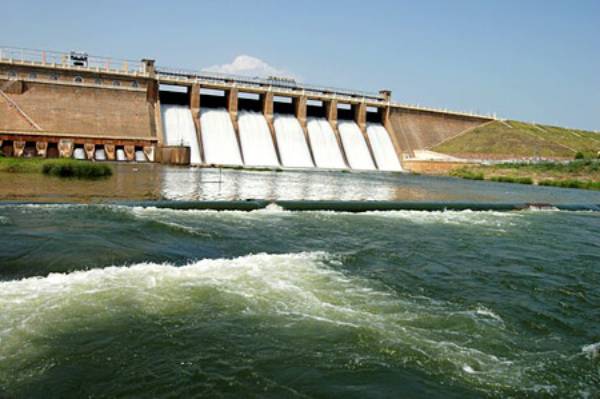
The Dam across the river Vaigai, known as the Vaigai Dam was constructed in January 1959 by then Chief Minister of TamilNadu Kamarajar. This Dam can store up to 71 feet out of its total height of 111 feet and has the capacity of storing 6143 mcft.
- This Vaigai Dam serves as the source of drinking water supply and irrigation for the agricultural fields in the Madurai District.
- Then this river generates more than 6MW of power.
This river irrigates the crops like the peas, black gram , rice, sorgham and cotton.
Flowing State: Tamil Nadu
Flow area:258Km ( source to sea)
Origin Place: Varusanadu Hills, Western Ghats, Tamil Nadu.
