The river Thamirabarani emerges from the top of the Pothigai hills, which is at the height of 1725 metres above the sea level. This river starts from the Western Ghats, since the Pothigai hills is situated in the Western Ghats. As it flows through the Tuticorin and the Tirunelveli Districts in TamilNadu, this serves as a source of water in these Districts.
Why name Thamirabharani?
This river got its name from the Tamil word “tamiran” which means copper. Since the traces of the copper metal was found in this river, this river is known as Thamirabarani. Apart from the metal traces, a lot of medicinal properties are found in this river, as this flows from the Podhigai hills where many of the medicinal plants and shrubs grow.
Tributaries
The tributary rivers of this main river Thamirabarani are the Karaiyar, Maniamuthar river, Peyar, Servalar river, Gadananthi river, Ullar , Pachaiyar river, Pambar and the Ramanathi river.
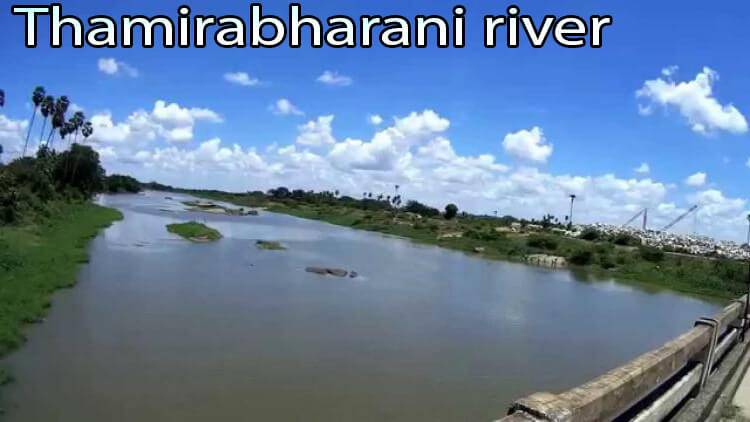
Flowing areas
Thamirabarani river covers the Districts of the Thoothukudi and the Tirunelveli. This river basin comes under the administrative limits of the places like Tenkasi, Sankarankoil, Shencottah, Ambasamudram, Alangulam, Nanguneri, Veerakeralamputhu, Paalayamkottai of Tirunelveli District. Then it covers the areas like the Ottapidaram, Kovilpattu, Srivaikundam of the Thoothukudi District. This river flows at a distance of 128Km from its source to sea.
Uses of Thamirabarani river
- The number of dams and the reservoirs of this river along with the Manimuthar river acts as an irrigation source for the Tirunelveli District.
- Also the dams of this river helps in electric power generation.
- Then the water of this river tastes good and proves to be healthy with the copper content that enhances the immune system of the body.
- This river branches into the main irrigational channels from both sides of its banks.To obtain more information about other famous river vaigai
Construction of Dams
There were seven anaicuts(dams) on this river was built at the period of ancient and medieval Kings. Then the construction of the last dam was completed by the British rulers in 1869. The old name of this river is Porunai in Tamil.
The seven dams across this river are the Kodaimelaalagain anaicut, Kannadian anaicut, Nathiyunni anaicut, Ariyanayagipuram anaicut,Palavur anaicut, Marudar anaicut and the Suthamalli anaicut.
Aquatic life in Thamirabarani river
Thambirabarani river is one of the perennial rivers in TamilNadu with the full of fishes. The commonly found variety of fishes found in the river are the Catfish, Snakehead, Gar, Carp Roaches, Alligator, Eels ,Loaches , Plecos, Devario, Mystus, Devario, Puntius, Aplocheilus, Garra, Dawkinsia, Glosssogobius, Batasio, Macrognathus, Barilius, badidae, Nemacheilus, Oreichthys, Osteobrama, Oryzias, Salmophasia, Raiamas, Clupisoma, Xenentodon and Tor.
History
As per the local sources, this river had the name Tampraparani, Tamirabarani and Tamiravaruni in earlier days. This river was mentioned as a holy river in the Sanskrit holy books like the Ramayana and the Mahabharata. During the period of King Pandyan , this river was well known for its pearl, fishery, conch and other trades. In the earlier periods, the residents from this region led a movement from the Tamraparni river to the North Western Sri Lanka which caused the sharing of name in the closely connected places. Then the important historical document on this Thamirabarani river is the Tamraparni Mahatmyam. This river has many historical temples on its banks. On the northern part of this river, there is a small village called the Appan Koil.
River drain
The river watercourse into the Gulf of Mannar which is in the Tiruchendur of Tuticorin District. Thamirabarani drains in a total area of 4400 sq.Km. This area lies in the Western Ghats that enjoys both the monsoons, due to which water never dries up in this river. Thus this river and its tributaries are perennial. During the time of the northeast monsoon this river experiences a heavy flood. Then the heavy flood in this river always causes the water to flow into the Kurukarai Murugan Temple.
Flowing State: TamilNadu
Flow area: 128Km (source to sea)
Origin Place: Pothigai Hills, Western Ghats, Tamil Nadu